A powerful cold front is beginning to impact our area, bringing with it a multitude of hazards through tomorrow. The main concerns are:
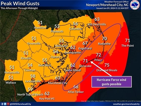
- Very strong winds, especially over the Outer Banks where gusts to hurricane force are possible late tonight
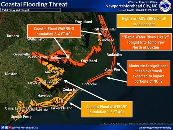
- Moderate to significant coastal inundation, with rapid water rises likely
- Scattered severe thunderstorms, with the potential for wind gusts up to 80 mph and a few (possibly strong) tornadoes.
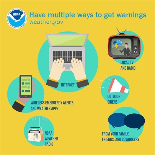
You can find our latest briefing at the link below. Remember to have multiple way to receive warnings and remain weather aware throughout the day.
https://www.weather.gov/media/mhx/LatestBriefing.pdf
**Soundside Nags Head: be ready for the potential for rapidly rising water when the winds switch to the southwest/west with this storm, which is forecasted to take place overnight.
*** When rare weather like this is possible, focus on what you have control over. Do you have multiple ways to receive warnings, and at least one that will work when the power goes out?
Later today thunderstorms have the potential to produce STRONG winds and a few STRONG tornadoes. We are in the "hatched" area for both wind and tornadoes, meaning significant wind (74+ MPH) and significant tornadoes (EF2+) are possible. A RARE event for January (according to our National Weather Service office).
Be sure to monitor our local National Weather Service office for more information.